Complex Building Survey in a Forested Area Using SL9 SLAM RTK
Proje Arka Planı
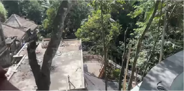
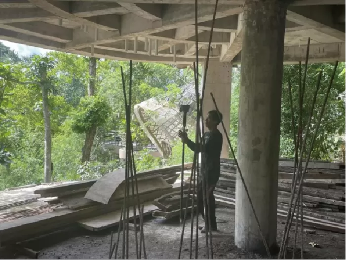
This project involved surveying and as-built documentation of a resort property in Bali. The resort is located within a densely wooded area, and the survey focused on a building that had been constructed but not yet finished. The client required high-quality point cloud data suitable for as-built verification and indoor modeling, providing a reliable basis for subsequent design, interior fit-out, or renovation planning. In addition, the project demanded the integration of indoor and outdoor coordinates through RTK or control points to ensure a consistent and accurate spatial reference.
Zorluklar
The dense vegetation and steep terrain severely obstructed GNSS signals and limited line-of-sight, making traditional RTK surveying unreliable. Although total stations offer high accuracy, the complex environment and large slopes made instrument setup, relocation, and measurement inconvenient and time-consuming, resulting in low efficiency that could not meet project timelines. Meanwhile, the client’s strict requirements for point cloud quality—accurate wall lines, clear structural representation, and smooth surfaces—posed further challenges that conventional surveying methods struggled to satisfy.
Çözüm
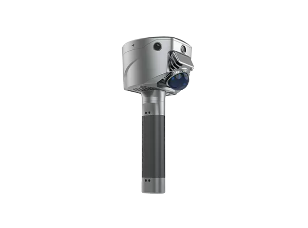
To address the challenges of a complex site environment and high-quality point cloud requirements, the SL9 SLAM RTK system was deployed. By combining SLAM laser scanning with RTK positioning, SL9 efficiently captured continuous, stable spatial data even under dense canopy and limited GNSS conditions. This approach ensured engineering-grade point cloud quality while maintaining operational efficiency, providing a reliable foundation for as-built documentation, indoor modeling, and subsequent design or renovation applications.
İş akışı
1.Quick Deployment and One-Touch Scanning
The SL9 SLAM RTK features an integrated design, allowing operators to start scanning with a single touch on the screen. Even non-specialist personnel can independently perform the survey after brief training, reducing labor and training costs.
2. RTK-Enabled, Scan-to-Map Workflow
The built-in RTK system enables operators to scan areas of interest without following strict paths, offering flexibility and efficiency in complex building environments.
3. Unified Indoor-Outdoor Coordinate System
Equipped with a high-precision RTK module, SL9 ensures indoor and outdoor data are aligned within a single spatial reference, facilitating seamless integration for design, construction, and management purposes
Sonuçlar
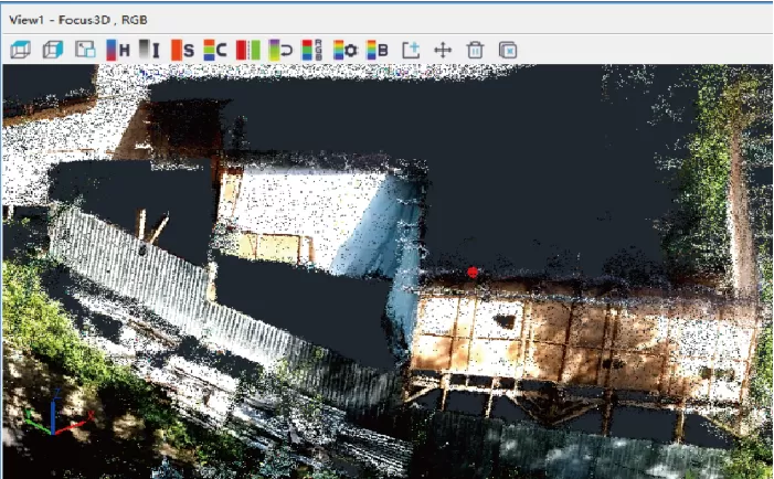
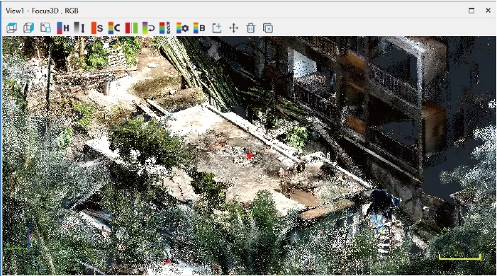
1. High-Quality Point Clouds
The resulting point clouds clearly represent walls, columns, and structural elements with smooth surfaces and minimal noise, accurately reflecting the as-built condition of the building.
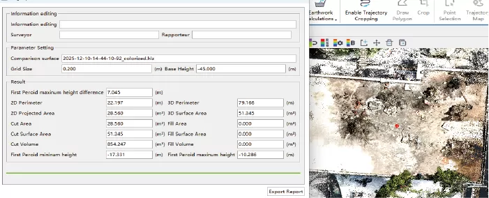
2. Fast Measurement and Quantification
From the point cloud, operators can quickly calculate building perimeter, floor area, and volume, facilitating property surveying, construction verification, and project management while minimizing repeat site visits.
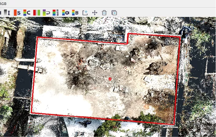
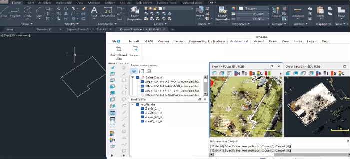
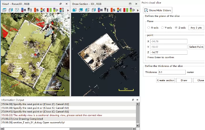
3. Point Cloud Slicing and CAD Integration
Data can be imported into SAT-LiDAR software for slicing, extracting precise wall lines and structural boundaries. The vectorized output can be seamlessly imported into CAD for drafting, measurement, and engineering analysis, completing a fully integrated workflow from on-site acquisition to project documentation.