Full-Scene Bridge Inspection with UAV LiDAR & USV Multibeam Solution
Brief
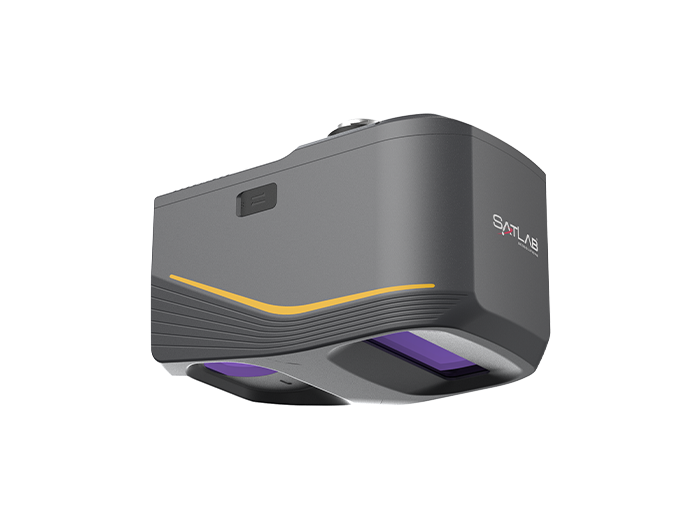
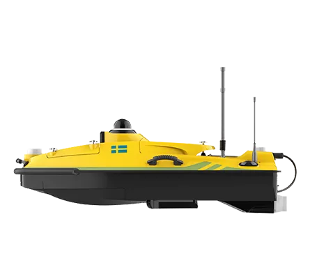
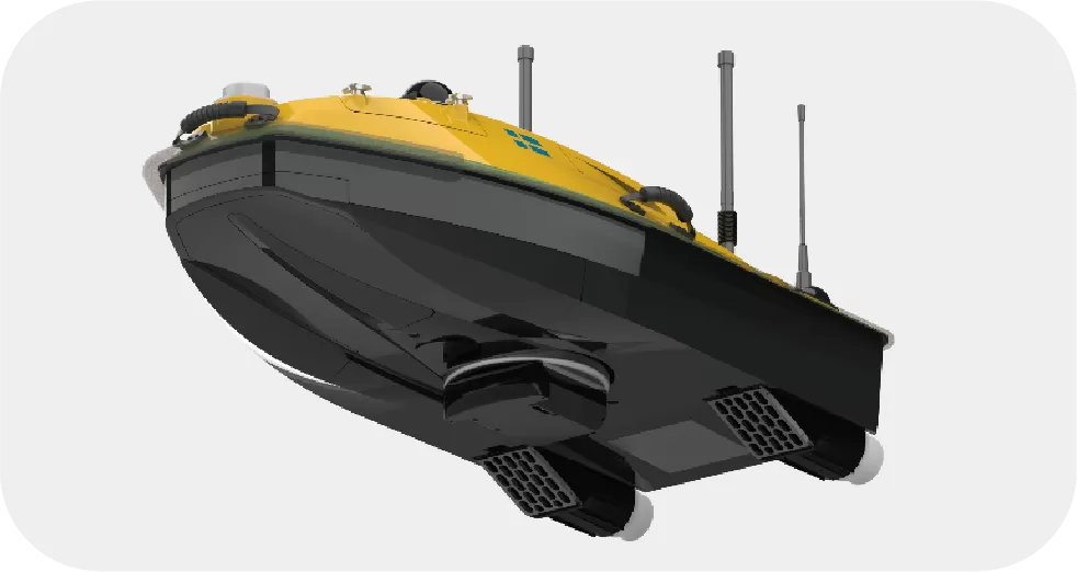
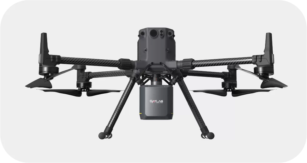
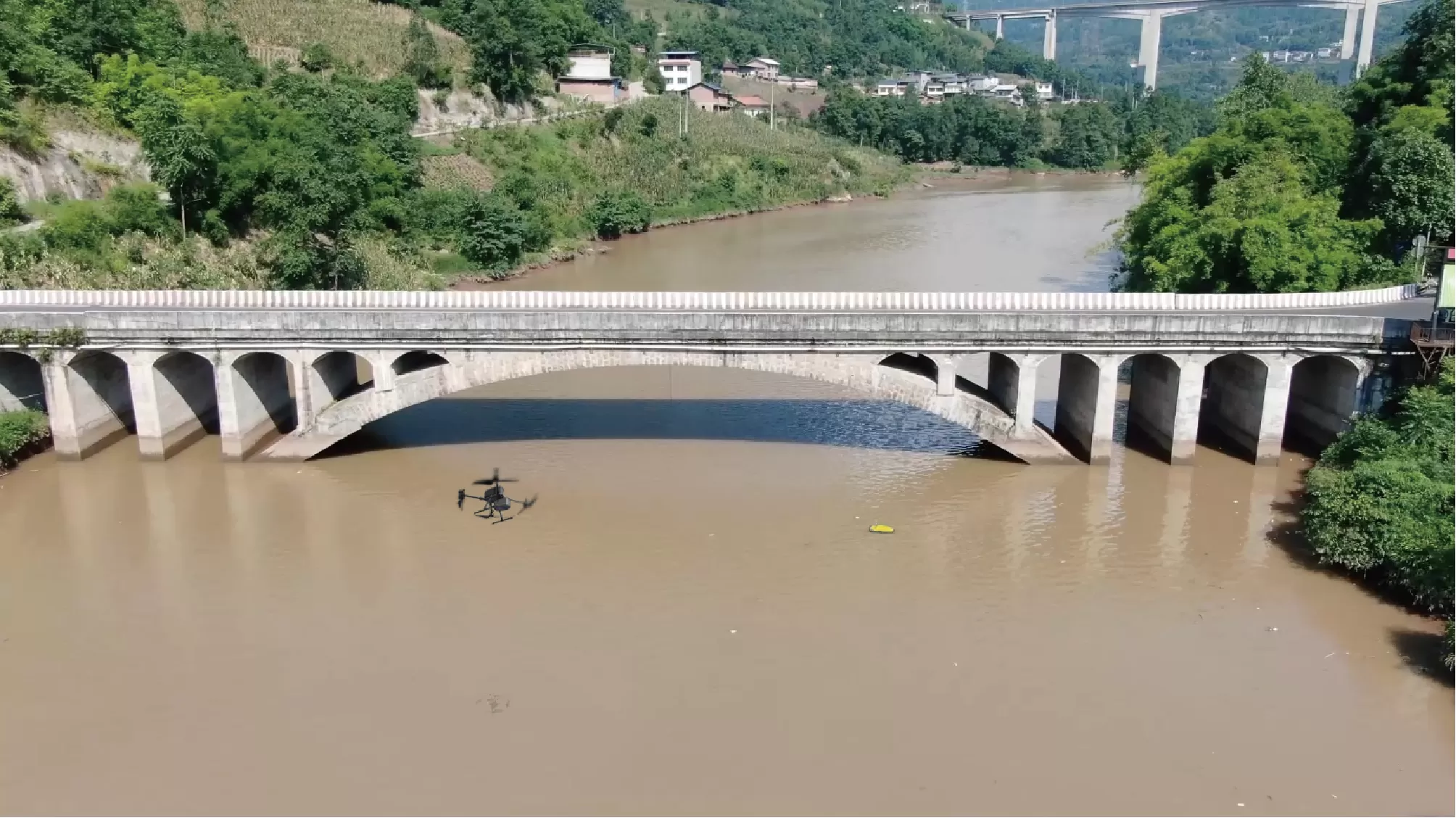
This case study demonstrates an integrated UAV–USV inspection workflow combining SatLab’s HydroBoat 1200MB with the Apus-MX LiDAR on DJI M350 RTK. The solution enables seamless data acquisition from riverbed to bridge superstructure, delivering a true 3D view from riverbed to deck that enables accurate assessment, safer operations, and smarter lifecycle management.
Challenges
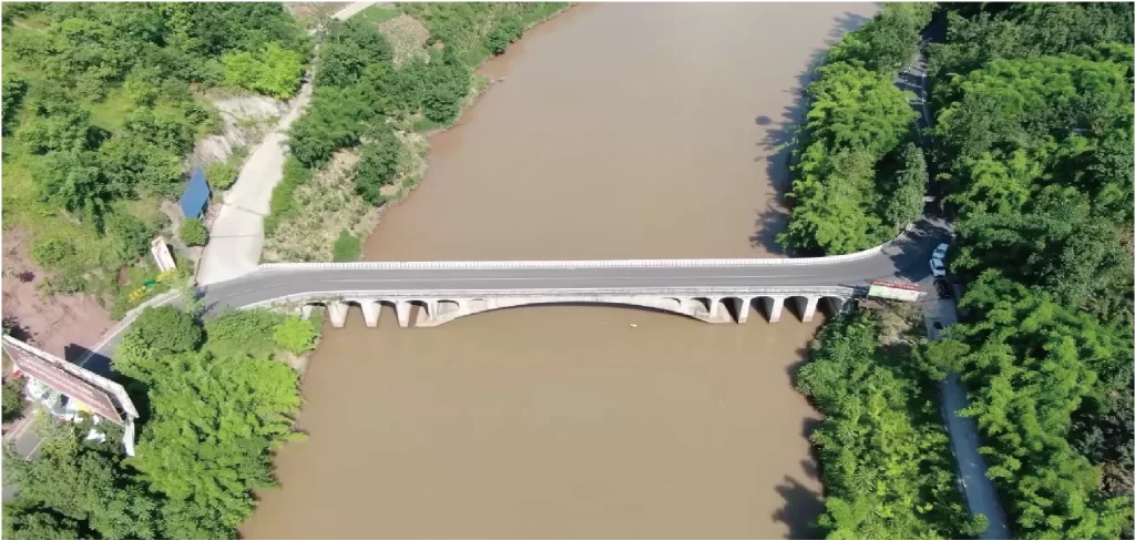
The project site was a major cross-river bridge with submerged pier foundations, narrow channels, shallow wetlands, and elevated structural elements. Traditional inspection methods face multiple limitations:
-
-
- Accessibility limitations: Diver surveys and manned vessels are constrained by water flow, turbidity, and tight pier areas.
- Safety risks: High-altitude or underwater manual inspections expose personnel to hazards.
- Fragmented datasets: Above- and below-water surveys rarely integrate seamlessly, making complete 3D modeling and structural assessment difficult.
-
An integrated above-and-below-water solution was required to provide a complete, accurate, and safe structural assessment.
Solution
SatLab implemented a dual-platform inspection workflow:
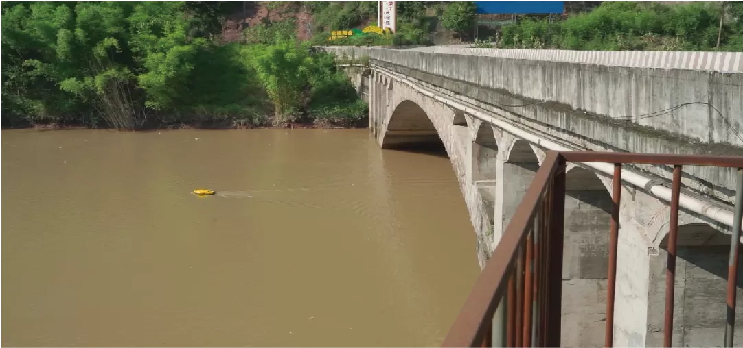
- HydroBoat 1200MB — USV Multibeam Solution
- Provides high-resolution bathymetric mapping and pier foundation surveys
- Supports rapid deployment and flexible supplemental surveys
- Navigates autonomously with obstacle avoidance in confined or complex areas
- Measures accurately without SVP, maintaining precision while simplifying workflow and improving efficiency
- Performs reliable data acquisition even in low-visibility waters
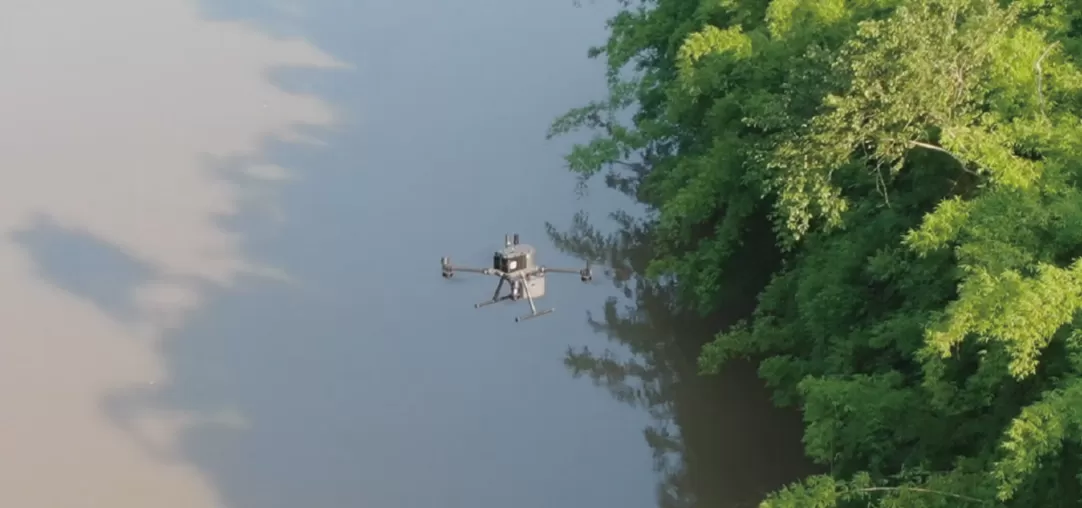
- DJI M350 RTK + Apus-MX LiDAR — UAV LiDAR Solution
- Rapid, high-density 3D point cloud acquisition of bridge decks, piers, soffits, and surrounding terrain
- Detects fine-scale defects such as cracks, spalling, or corrosion
- Agile flight paths enable coverage of complex structural geometries with no blind spots
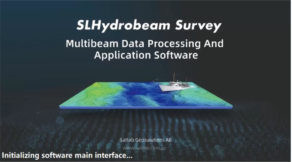
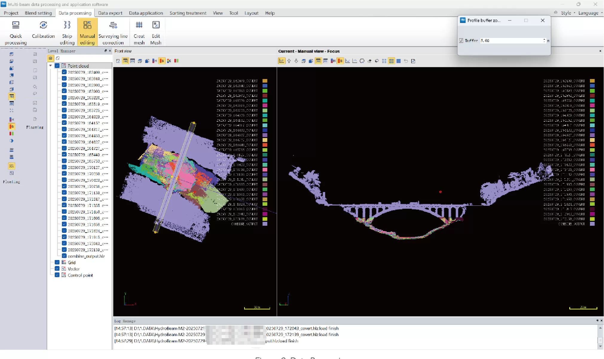
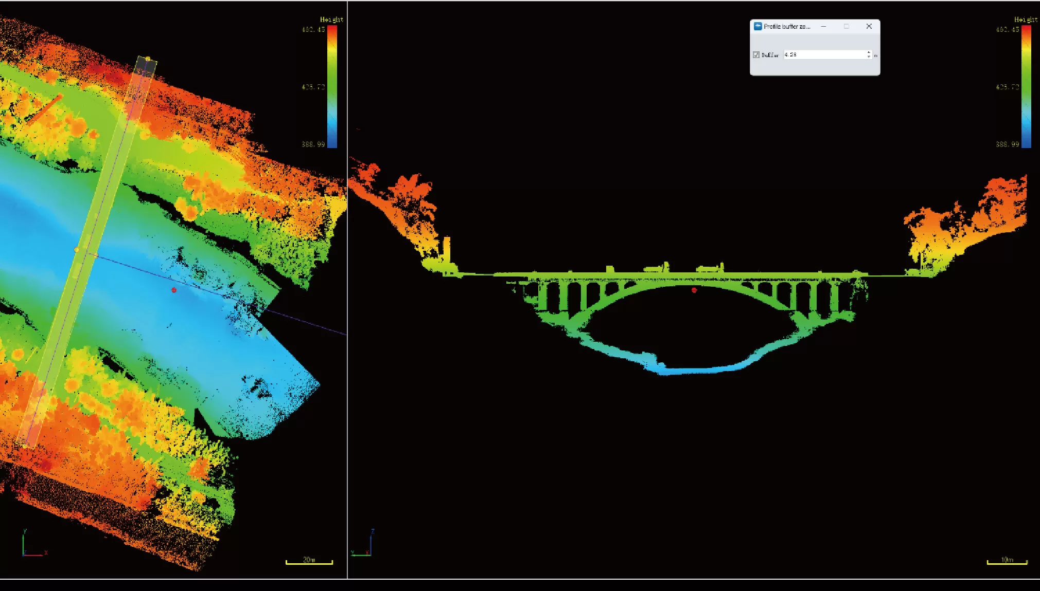
- SLHydroBeam Processing Software — Data Integration Platform
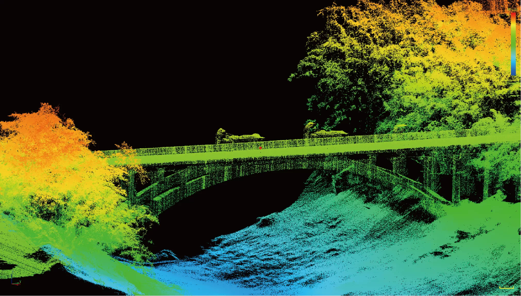
- Integrates sonar and LiDAR datasets into a single 3D digital twin
- Supports automated modeling, defect detection, and analytical reporting
By synchronizing UAV and USV operations, the solution delivered seamless data fusion — bridging the gap between underwater and aerial inspection.
Operational Workflow
1. Plan Missions
Define USV routes and UAV flight paths based on design drawings and terrain; align control points and coordinate systems.
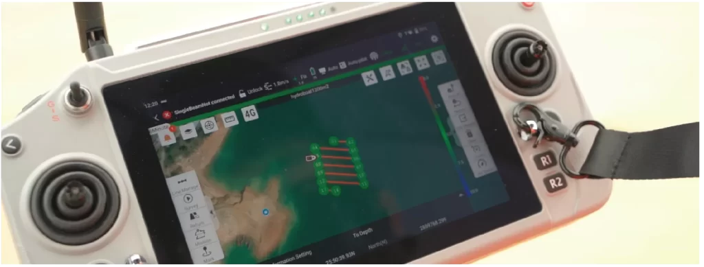
2. Acquire Data
USV runs sonar lines along pier axes; UAV performs cross-hatch LiDAR passes over deck and soffits simultaneously.
3.Verify On-Site
Real-time monitoring of coverage and overlaps; cross-checks with control points to ensure positional accuracy.
4.Process & Fuse Data
- Multibeam: motion/tide corrections, filtering, bathymetric gridding
- LiDAR: strip adjustment, intensity calibration, fine registration
- Fusion: seamless alignment into a superstructure-to-substructure model
Deliverables
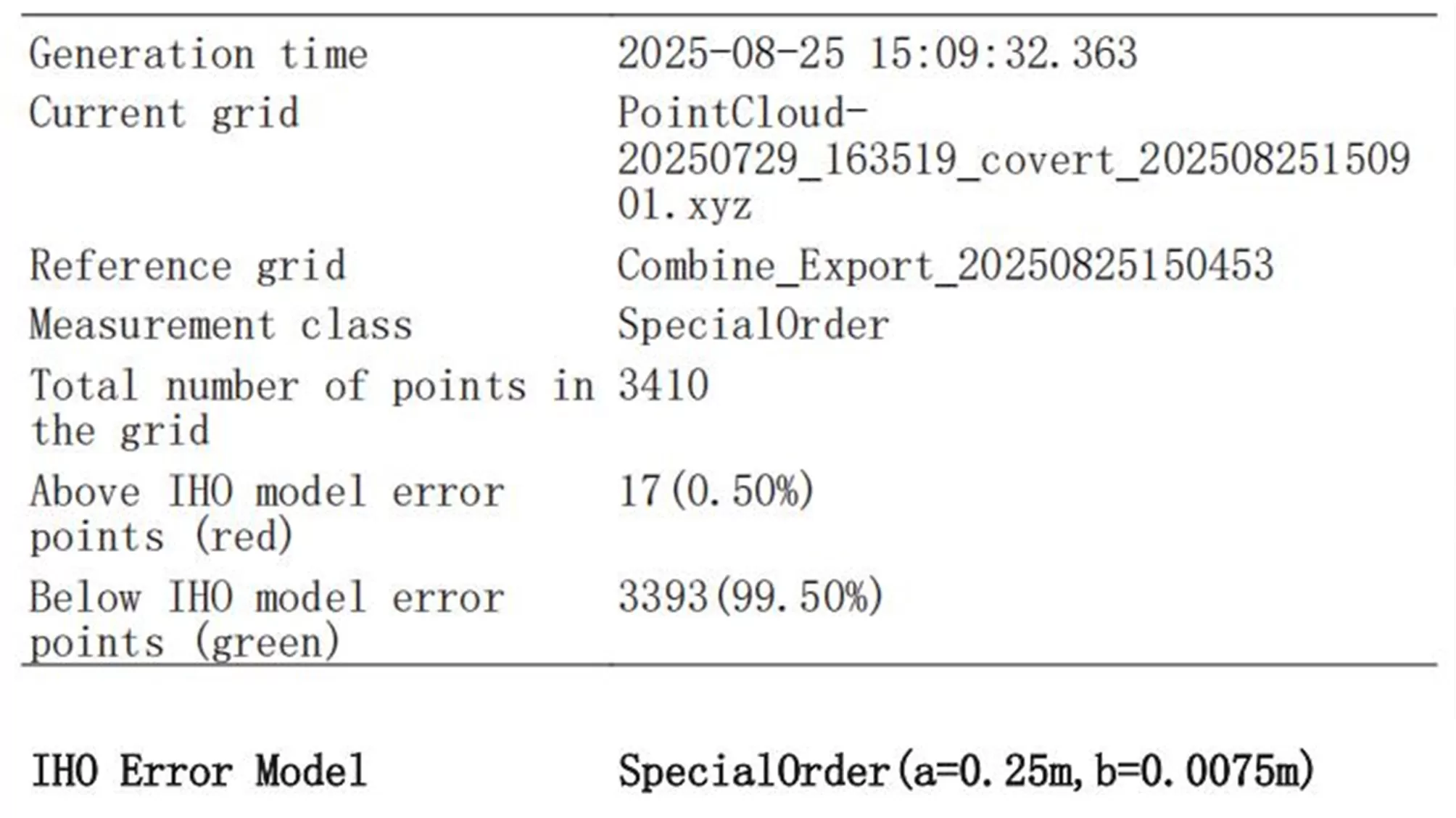
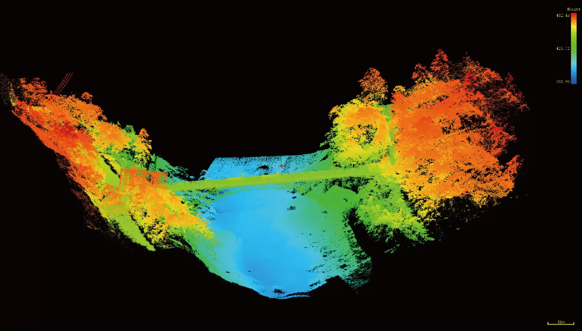
The project delivered a comprehensive 3D digital twin that seamlessly integrates sonar and LiDAR datasets. The model contains detailed thematic layers, including scour depth, pier geometry, crack distribution, and clearance profiles, providing a complete structural dataset ready for inspection and analysis.
Benefits
- Complete Full-Scene Coverage
Unlike traditional methods that often miss underwater or high-altitude zones, the integrated sonar and LiDAR workflow ensured full coverage from riverbed to superstructure. - High-Resolution Precision
The workflow captured fine structural details, providing the level of accuracy needed for reliable scour and defect assessment. - Enhanced Efficiency & Safety
Inspection time was significantly reduced, while human exposure to hazardous underwater and high-altitude operations was minimized. - Digital Twin Output
Delivered a fully integrated 3D model, enabling continuous monitoring, condition assessment, and predictive maintenance planning.
Conclusion
The coordinated use of UAV LiDAR and USV multibeam sonar provides true surface-to-subsurface inspection, empowering operators with a smarter, safer, and more complete way to manage bridge infrastructure — from today’s inspections to tomorrow’s predictive maintenance. SatLab’s integrated workflow delivers reliable, comprehensive, and decision-ready data for efficient and fully-informed infrastructure management.