HydroBeam M4による垂直峡谷の精密水深測量
プロジェクトの背景
狭い川が、険しくほぼ垂直な岩壁が両側にそびえ立つ壮大な峡谷を蛇行している。水深は予測不可能に変動し、1メートルほどの浅瀬から20メートルもの深い淵まで、変化に富んだ水中地形を作り出している。地元の水力発電所にとって、この地形を正確に把握することは、単なる技術的な作業ではなく、操業の安全性を確保する上で極めて重要である。 従来の測量ツールでは、このようなほぼ垂直な峡谷の壁に沿って信頼性の高い測定値を得ることが難しく、データに欠落が生じ、リスクが増大する。
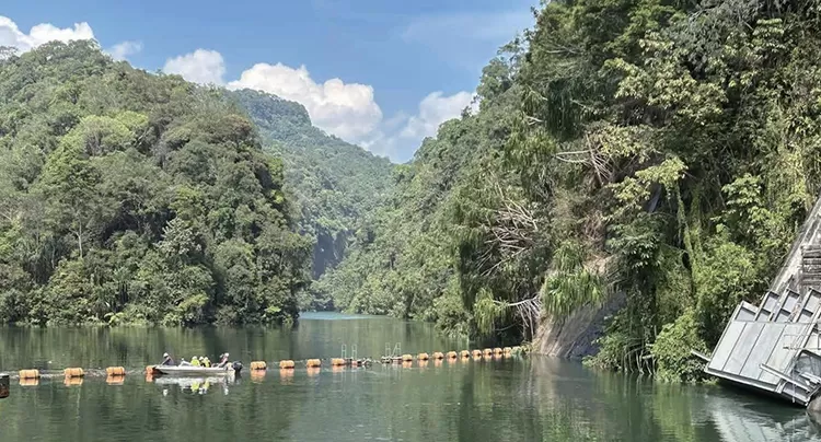
図1:水力発電所
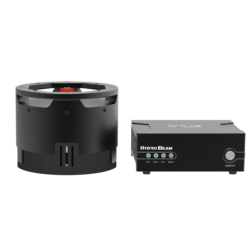
これらの課題を克服するため、プロジェクトチームは、複雑で垂直な水中地形における高精度な水路測量のために特別に設計されたマルチビーム音響測深機「HydroBeam M4」を導入した。
表面下に潜む課題
このような峡谷の測量には、複数の障害が伴う。
-
-
- 狭い空間:川の一部区間は幅が20メートル未満しかない。
- 垂直な壁:急な傾斜はビームの歪みや予測不可能な音響反射を引き起こす。
- 水深が変化する:浅瀬と深瀬の間が急激に変化するため、一貫した測定が困難である。
- 音響異常:峡谷の壁、川底、水面の間での多重反射により、ノイズの多いデータや誤解を招くデータが生じる可能性がある。
-
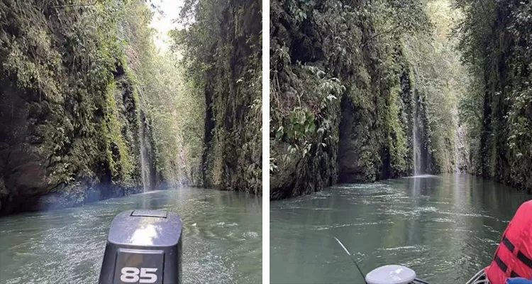
図2:河川の両岸にそびえる垂直の岩壁
ソリューションの展開
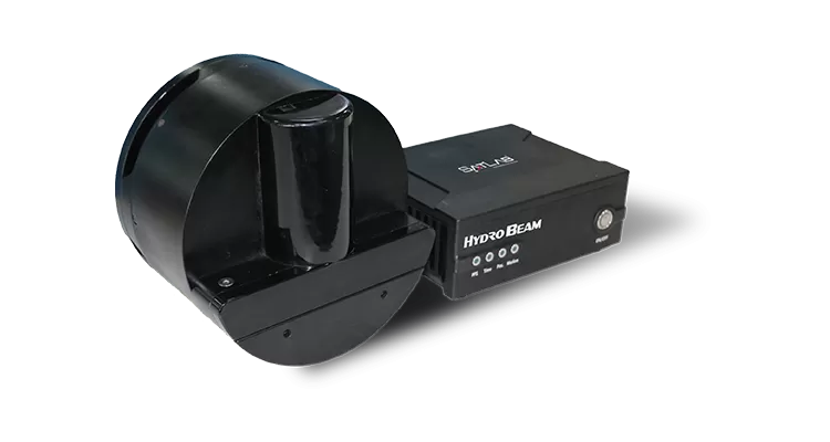
図3:ハイドロビームM4マルチビーム音響測深機
プロジェクトチームは、これらの課題に正面から取り組むために、ハイドロビームM4の高度な機能を活用しました。
-
-
- 150°の走査範囲で、側壁データの取得範囲を拡大
- 1024本のビームにより、高密度で高解像度の海底地形点群データが得られます。
- 垂直地形アルゴリズムにより、急斜面や垂直壁面でも安定した計測が可能です。
- 統合されたGNSS、IMU、SVSにより、設置が簡素化され、高精度な測位とモーション補正が可能になります。
-
データ取得ワークフロー
1.測量線計画
-
-
- 完全なカバレッジを確保するために、30%以上の重複を持つ平行な調査ライン。
- 主要な地形地点で収集された校正測定値
-
2.現地調査
-
- HydroBeam M4を搭載した小型有人調査船
- 音速プロファイルは、音の伝播変動を補正するために複数の場所で測定された。
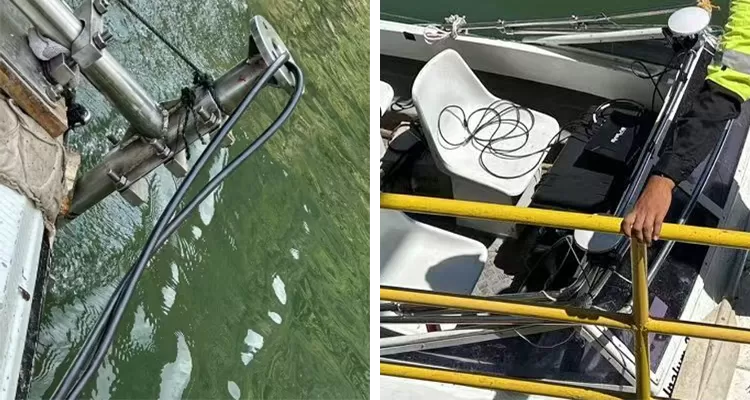
図4:小型有人調査船に搭載されたHydroBeam M4
3.リアルタイム取得
-
- HydroBeam Monitorソフトウェアは、安定したデータが得られるようにシステムパラメータを自動的に調整します。
- SLHydro Surveyソフトウェアはデータを収集し、リアルタイムで可視化します。
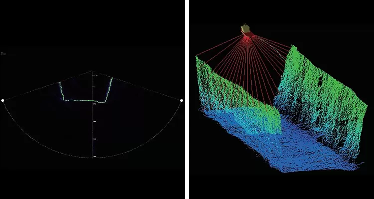
図5:リアルタイムデータ可視化
データ処理
ソフトウェア:後処理にはSLHydro Surveyを使用
-
-
- データ統合:GNSS、IMU、マルチビームの測定値をキャリブレーションパラメータと統合
- ノイズフィルタリング:異常または誤った深度点の除去
- 出力:工学的解析に適した高解像度3D水中点群、等高線図、および断面プロファイル
-
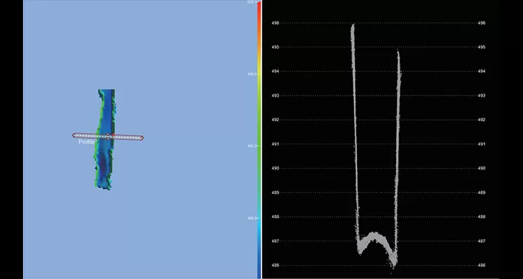
図6:調査データの事後処理
成果物
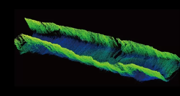
図7:3D水中点群可視化
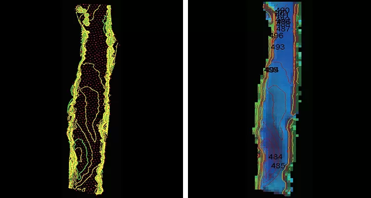
図8:水深等高線図
この峡谷測量によって、HydroBeam M4が困難な垂直地形における画期的なソリューションであることが証明されました。信頼性と精度に優れた高解像度の測深データを広範囲に提供することで、技術者やオペレーターは自信を持って意思決定を行うことができ、水路測量における新たな基準を確立します。
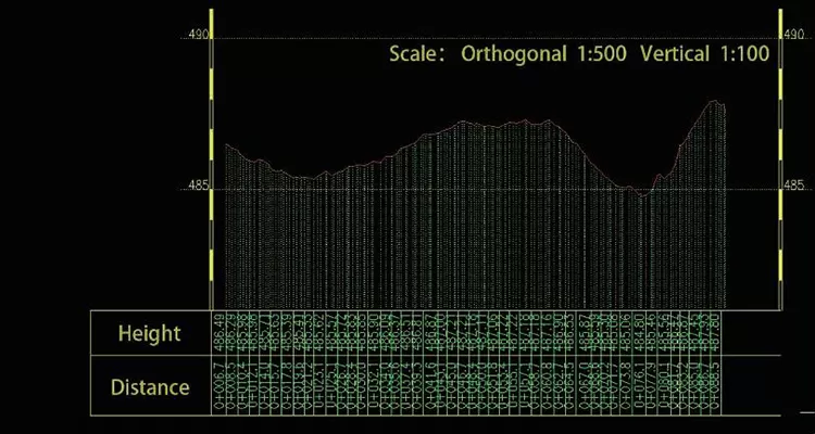
図9:河川の横断面図
プロジェクトの成果
HydroBeam M4マルチビーム音響測深機は、複雑な垂直峡谷の測量を、高精度、高効率、かつ信頼性の高い作業へと変革することに成功しました。高解像度で広範囲をカバーする水深データを提供するだけでなく、技術者や水力発電事業者が自信を持って情報に基づいた意思決定を行えるように支援し、困難な環境下における水路測量の基準を再定義します。