Apus-MX UAV LiDAR Maps Portugal’s Largest Biofuel Plant
Introduction
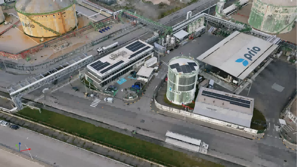
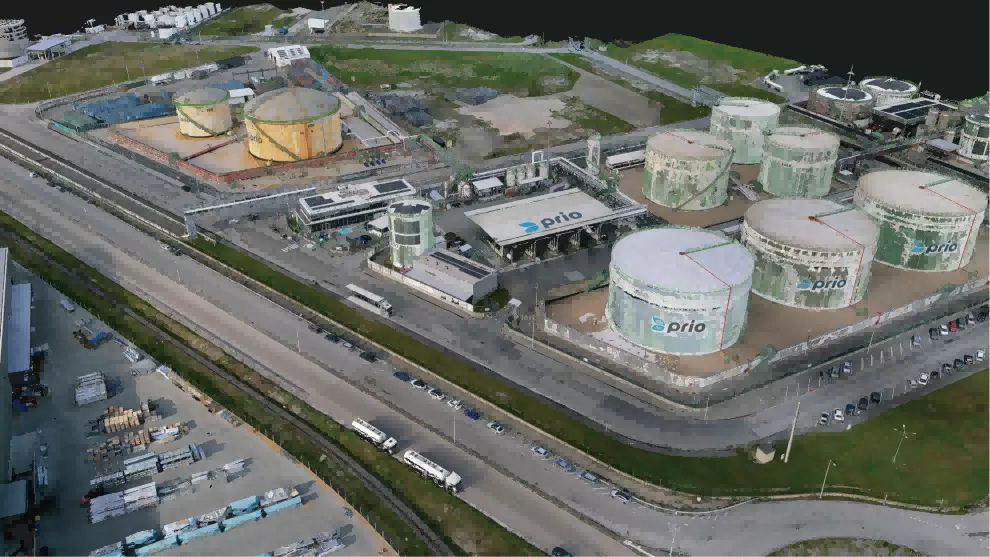
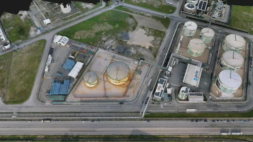
This case study demonstrates how the SatLab Apus-MX UAV LiDAR system enabled Portugal’s largest biofuel plant to capture high-density point clouds with sub-5 cm accuracy overall and 1–2 cm precision in key zones, creating a highly precise digital twin for facility management.
The Challenge
The largest biofuel plant in Portugal operates a large, complex facility with extensive pipelines and industrial equipment.
They needed a high-precision digital twin to:
• Improve operational efficiency
• Support predictive maintenance
• Enable proactive facility management
Traditional survey methods were slow, labor-intensive, and lacked the detail required for accurate modeling. The company sought a solution that could capture the entire site accurately and quickly
Solution
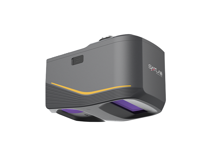
The use of a UAV LiDAR system was essential to meet the project’s goals. The client chose the SatLab Apus MX for its:
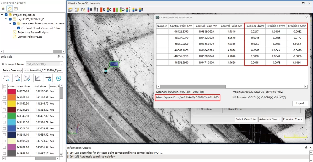
• Precision – Sub-5 cm accuracy, 1–2 cm in key zones
• Ease of Use – User-friendly workflow, minimal training required
• Automation – Automatic GCP recognition & one-click strip alignment
• Power & Portability – Lightweight design for sites with strict flight constraints
• Full-site scan in 1 day — more than 50% time and labor saved, with high-density point clouds ready for
seamless digital twin integration.
Results
1. Pinpoint Precision for Confident Decisions
The Apus MX UAV LiDAR System delivered sub-5 cm point cloud accuracy, capturing every pipe, structure, and terrain feature, including the surrounding topography. This enabled precise equipment and infrastructure placement, comprehensive terrain modeling for site planning, and fewer reworks thanks to highly reliable data.
2. From Reactive to Proactive Operations
Regular LiDAR scans generated detailed 3D models, allowing the client to measure distances and heights instantly and identify structural issues before they escalate. According to the client, “Apus MX shifts us from reactive maintenance to proactive management — efficiency is up 30%!”
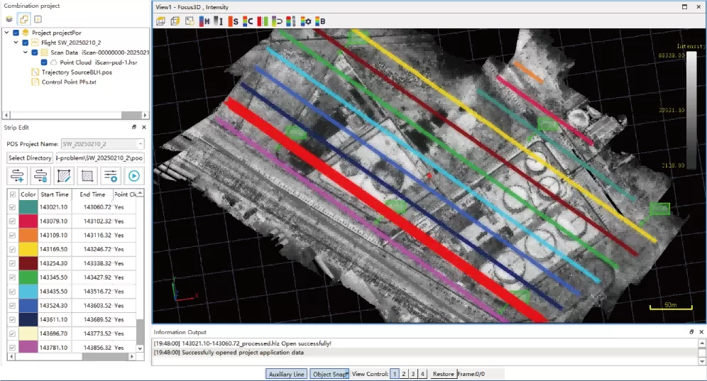
3. Intelligent Workflow, Maximum Efficiency
Automated target recognition and flight strip alignment streamlined data capture, reducing survey cycles and accelerating data analysis. Teams quickly transformed LiDAR data into actionable deliverables.
4. Turn Data Into Operational Intelligence
High-density Apus MX point clouds feed directly into digital systems, supporting real-time monitoring, predictive maintenance, and smarter decision-making across the facility. With 1–2 cm accuracy in key areas, the client gained a robust foundation for planning, operations, and long-term management.
Conclusion
Beyond industrial applications, Apus MX is equally effective for a wide range of surveying projects in challenging environments. It can generate DEMs and contours for terrain mapping, penetrate vegetation to reveal subtle archaeological features, analyze canopy and ground layers in forestry, and support post-disaster assessments by capturing changes for emergency planning.